If you’re going to be a good outdoorsman out West, you’re going to have to learn some basic map-reading skills to be successful.
I say this for a multitude of reasons. First off, you don’t want to always be lost. Or, if you find a good hunting/fishing spot, you want to be able to find that spot again.
In the old days, I always used the old Forest Service maps and I still do for some general purposes. But after I figure out where I want to go, I grab a MyTopo map. They’re by far the the most detailed, the most accurate and overall best maps on the market.
If I could only have one map, it’d be their 1:24,000 scale map. On the map, 2 and 3/4-inches equal one mile. This is my general hunting map. I can look at it and tell where I want to go, the layout of the land and the terrain. Not always, but many times if you’ve seen animals grazing, you can figure out where they might be going to bed down. You can also find high mountain lakes, rivers to fish and so forth.
If you have narrowed down to the spot you want to hunt or hike into to go fishing, you might want to get one of their 1:15,000 maps. This one is more detailed. Four and a quarter inches equal one mile on this map.
Then, if you want one that is super detailed, then order their 1:500 scale map. On this one, 1 and 1/4-inches equal 500 feet, so it is super detailed. If I’m wanting to figure out what is going on in one small area, this is the map I get.
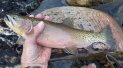
For instance, this summer when we flew into the Frank Church River of No Return Wilderness Area, I ordered one of these for where we were camping. I’m glad that I did because it is my only map that points out where some Indian petroglyphs are, so that was cool to find them and take some pics.
I can’t say this is true for all maps, but for MyTopo maps and the Forest Service maps, they have the Game Management Units marked on them. That’s handy, so you know which tag to buy and whether you’re hunting in the right spot or not.
Now let’s get back to some basic map-reading skills. As far as I know, they’re all color-coded the same. Here’s some of the important colors for me:
Dark Green: Wilderness
Lighter Green: National Forest
Yellow: Bureau of Land Management
White: Private
Purple: State lands
I’m not smart enough to give the designations for trails in this article, but they have different colored lines and broken patterns that tell you if the road is a highway, 4-wheel drive or hiking path. A solid red line is a primary highway and broken red is a secondary highway.
They also tell you how steep the country is. If the lines are super close, it’s steep. You’ll be sucking wind. They also have the elevation written periodically on the map, peaks, etc.
What if there’s a big change in elevation in a short amount of time. Again, you’re sucking wind.
If the lines are spread way out, it’s a meadow. If you find a meadow in the middle of some dark timber and steeper country, you might have a spot where the elk come out to graze at dusk.
So how do you order maps? You can order them by GMU, GPS quadrants, certain locales, etc. So, As soon as I figure out where I’m going to be hunting/fishing or if I’m just exploring a new area, the first thing I do is order some maps.
Then as I find game or something interesting, I mark it on the map. That way, years later I can find the exact spot I shot a bull or a bear or if I caught some big fish.
And lastly, I should know the exact name but it’s nice to buy wax-coated maps (I don’t know if it’s actually wax). They last a lot longer than the old paper maps. Most maps come with this now, but in the old days they didn’t. Maps fell apart fast back then, which was a pain because you had to transfer all your markings to your new map.
Tom Claycomb lives in Idaho and has outdoors columns in newspapers in Alaska, Idaho, Utah, Nevada, Colorado and Louisiana. He also writes for various outdoors magazines and teaches outdoors seminars at stores like Cabela’s, Sportsman’s Warehouse and Bass Pro Shop.